



 Product PDF
 Spec Sheet PDF
 CAD DrawingCAD Drawing 2CAD Drawing 3
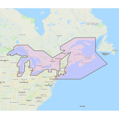
U.S. East Coast, Bahamas & Bermuda - Vector Charts & Standard Resolution Satellite Photos for Bahamas - Unlock Code
**SYSTEM ID NUMBER IS REQUIRED TO RECEIVE AN UNLOCK CODE**
This Chart Pack includes vector charts for United States East Coast, Bahamas and Bermuda, plus standard resolution satellite photography for the Bahamas.
These C-MAP charts are comprised of the same cartographic chart information found in C-MAP MAX and C-MAP MAX PRO charts.
Note that you will need to purchase an unlock code to view this chart data.
To purchase this chart pack for NavNet 3D, TZT or TZT2, you will need to provide your NavNet system ID to your local authorized Furuno dealer. The system ID can be located under the “My NavNet” menu.
 WARNING: This product can expose you to chemicals which are known to the State of California to cause cancer, birth defects or other reproductive harm. For more information go to P65Warnings.ca.gov.